
East of El Cajon, US 80 begins its ascent into the mountains. The Peninsular Range, locally known as the Laguna and Jacumba Mountains, present a rather unusual mountain crossing in California. Instead of many steep grades, shelf roads, and deep canyons, there are broad valleys and only a few steep grades. The most notable steep grade and deep canyon are both on the east side of the mountains. This area, known as In-Ko-Pah Gorge and Mountain Springs Grade, was also the site of a wagon road in the 1850’s. Even today, as I-8 passes through the area, it presents a challenge. When I-8 was constructed through the area, a separate canyon, Devils Canyon, was used for westbound traffic. Eastbound traffic continues to use the old US 80 alignment, albeit heavily modified.
As with any major mountain crossing, there are a few different alignments to follow. The majority of the most traversable alignment was constructed between 1926 and 1933. This roadway was paved with a good concrete surface, which is still in good shape today. Many bridges were also constructed during this period. Only a few of them have been modified or replaced since then.
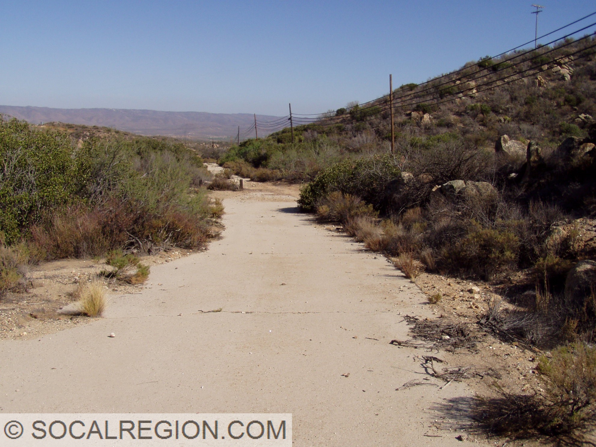
At various points, the original paving from the 1910’s was used as a base for the new paving, in others it was widened. A few sections of the original single-slab paving do exist, but are rare. The longest stretch of this paving is just east of the town of Boulevard and serves some houses adjacent to the current alignment. In other cases, the original alignment was unpaved and was bypassed so long ago that the roadway is no longer visible. This is the case near the junction with La Posta Road where the old alignment traverses a field south of the current alignment.
This tour will cover the bridges, the old alignments, and many other points of highway interest along US 80. Old and new maps will also be used to help describe places where the alignments get a bit more difficult to follow.
- Flinn Springs
- Alpine Area
- Viejas Area
- Sweetwater River / Descanso
- Guatay
- Pine Valley
- Laguna Summit
- Cottonwood Creek
- Kitchen Creek
- La Posta
- Live Oak Springs
- Boulevard / Manzanita
- Bankhead Springs
- Jacumba Hot Springs
- Desert View Tower
- Mountain Springs Grade / In-Ko-Pah Gorge
Video of the highway from Laguna Summit to Boulevard


Wisteria Candy Cottage – Great place for chocolates and fudge


Mountain Springs Grade / In-Ko-Pah Gorge:


Very good. I’ve been documenting my grandparents migration west on US 80 in 1936. They came from Philadelphia down to Meridian. Ms where they joined 80 west. It is very difficult to get views of the highway by it’s self. There are lots of postcards of cities but I wanted more than that and you have helped me understand the sometimes confusing alignments of this highway. I’ll bet you, a lot of politics went into determining the route of this Highway. Just to add, I was, as a child, a frequent user of Hwy 99 from Portland, Or to Stockton, Ca. in the late 40’s through to and beyond the creation of I-5. Thank you again. I do have one question, if you might respond, What would have been the main route from 80 north past the Salton Sea to San Berdoo !
Thank you for your compliments. US 99 was the main route from the Imperial Valley to San Bernardino. State 111 would have been the alternative between US 80 and Indio.